Importing files is incredibly helpful if your data set is very large but it is not limited to large data sets only. You can import a single file or create a data source that we will explain more about later.
1
Before starting your import, prepare your data first. Make sure you have at least one column to reference as the name or title of the location and then either an address field or separate latitude and longitude fields.
2
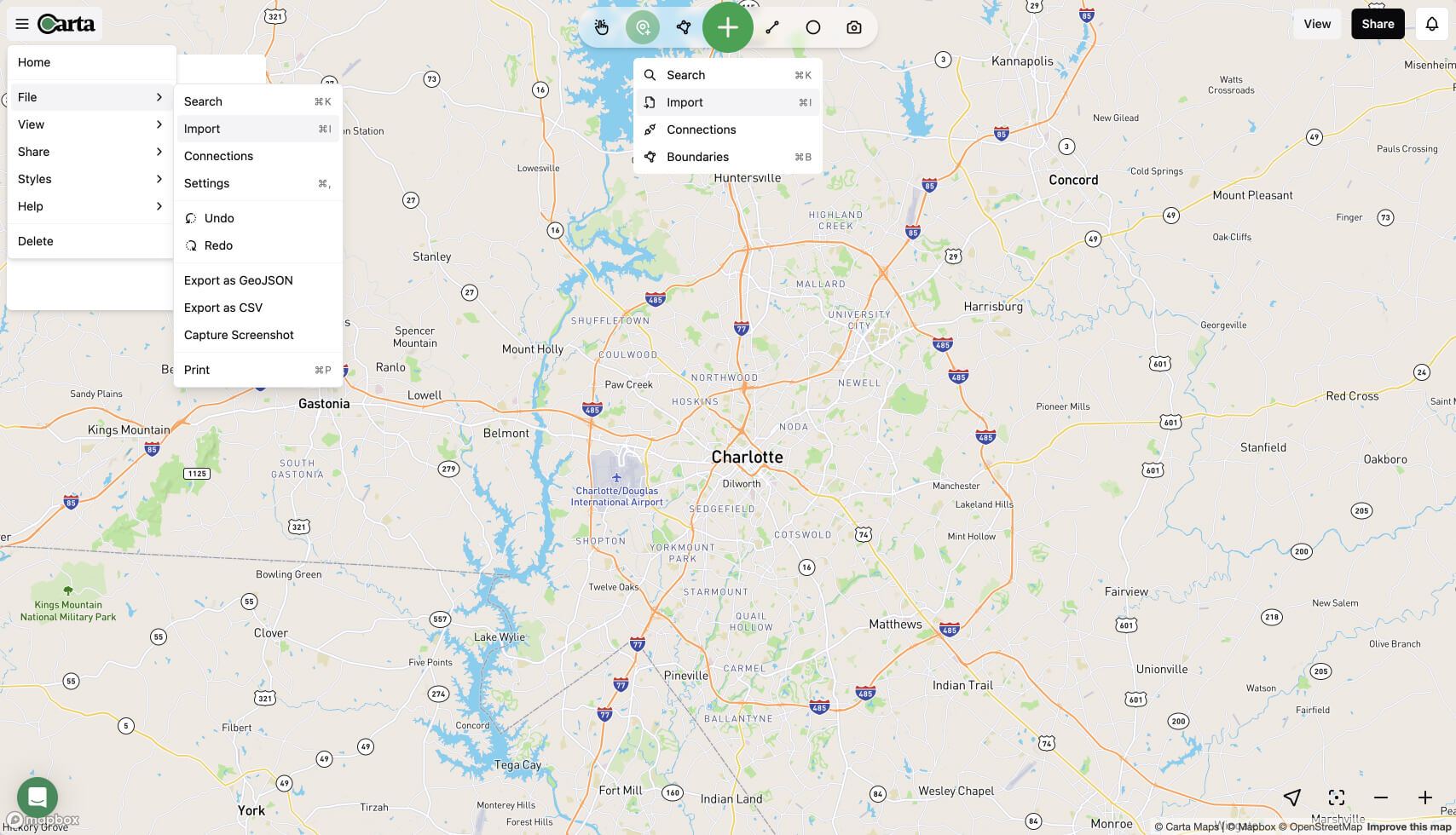
Once your data is ready, click on the large green "+" sign at the center and select "Import".
3
Clicking this option will open a large panel where you can click and choose your file or just drag and drop the file into.
4
Once the file is done uploading, you will be presented with a way to map your data fields into Carta Map required fields. Only required fields are the Name and the Address or the Latitude/Longitude fields. If latitude and longitude fields are found, they will take precedent, otherwise, we will geocode the address for you.
Image fields must be URLs to publicly available images.
5
When complete, hit import and watch as all your data is imported seamlessly.